


Voting District 0020, Harrison County, Texas
About
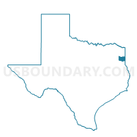
Outline

Summary
| Unique Area Identifier | 674529 |
| Name | Voting District 0020 |
| County | Harrison County |
| State | Texas |
| Area (square miles) | 52.69 |
| Land Area (square miles) | 52.52 |
| Water Area (square miles) | 0.17 |
| % of Land Area | 99.68 |
| % of Water Area | 0.32 |
| Latitude of the Internal Point | 32.49589290 |
| Longtitude of the Internal Point | -94.07456210 |
Maps


Graphs
Select a template below for downloading or customizing gragh for Voting District 0020, Harrison County, Texas


Neighbors
Neighoring Voting District (by Name) Neighboring Voting District on the Map
- Voting District 0005, Harrison County, TX
- Voting District 0006, Harrison County, TX
- Voting District 0007, Harrison County, TX
- Voting District 0009, Panola County, TX
- Voting District 0017, Harrison County, TX
- Precinct 133, Caddo Parish, LA
- Precinct 134, Caddo Parish, LA
- Precinct 136, Caddo Parish, LA
- Precinct 139, Caddo Parish, LA
Top 10 Neighboring County Subdivision (by Population) Neighboring County Subdivision on the Map
- District 12, Caddo Parish, LA (25,383)
- District 1, Caddo Parish, LA (20,040)
- Waskom CCD, Harrison County, TX (13,957)
- De Berry-Deadwood CCD, Panola County, TX (4,740)
Top 10 Neighboring Place (by Population) Neighboring Place on the Map
Top 10 Neighboring Unified School District (by Population) Neighboring Unified School District on the Map
- Caddo Parish School District, LA (254,969)
- Marshall Independent School District, TX (33,531)
- Elysian Fields Independent School District, TX (4,852)
- Waskom Independent School District, TX (4,355)
- Karnack Independent School District, TX (2,510)
Top 10 Neighboring State Legislative District Lower Chamber (by Population) Neighboring State Legislative District Lower Chamber on the Map
- State House District 5, TX (159,305)
- State House District 11, TX (151,703)
- State House District 1, LA (44,917)
Top 10 Neighboring State Legislative District Upper Chamber (by Population) Neighboring State Legislative District Upper Chamber on the Map
- State Senate District 1, TX (731,108)
- State Senate District 38, LA (120,165)
- State Senate District 39, LA (107,940)
Top 10 Neighboring 111th Congressional District (by Population) Neighboring 111th Congressional District on the Map
Top 10 Neighboring Census Tract (by Population) Neighboring Census Tract on the Map
- Census Tract 243.01, Caddo Parish, LA (7,037)
- Census Tract 245.04, Caddo Parish, LA (5,742)
- Census Tract 201.02, Harrison County, TX (5,686)
- Census Tract 243.04, Caddo Parish, LA (4,989)
- Census Tract 9501, Panola County, TX (4,740)
- Census Tract 201.03, Harrison County, TX (4,442)
- Census Tract 201.04, Harrison County, TX (3,829)
Top 10 Neighboring 5-Digit ZIP Code Tabulation Area (by Population) Neighboring 5-Digit ZIP Code Tabulation Area on the Map
- 71119, LA (11,562)
- 75692, TX (5,098)
- 71033, LA (3,510)
- 75639, TX (3,460)
- 71060, LA (3,089)
- 75661, TX (2,807)